Mangrove Restoration Potential Map
There is incredible potential for many of the world's mangrove areas to be restored to functioning habitat. But where are they? How do we decide where to focus our efforts, and what can be done to maximize our chances of success? With the help of a new interactive map tool, the potential for restoring more than 800,000 hectares of mangroves just may be possible.
With high levels of deforestation and degradation, restoration is increasingly seen as a critical component of both mangrove conservation and wise coastal management – a genuine ‘win-win’ opportunity. A new Mangrove Restoration Map shows that restoration of deforested mangroves worldwide could contribute to the storage of an extra 69 million tons of carbon in above-ground biomass and would also help to avoid further emissions of some 296 million tons of soil carbon.
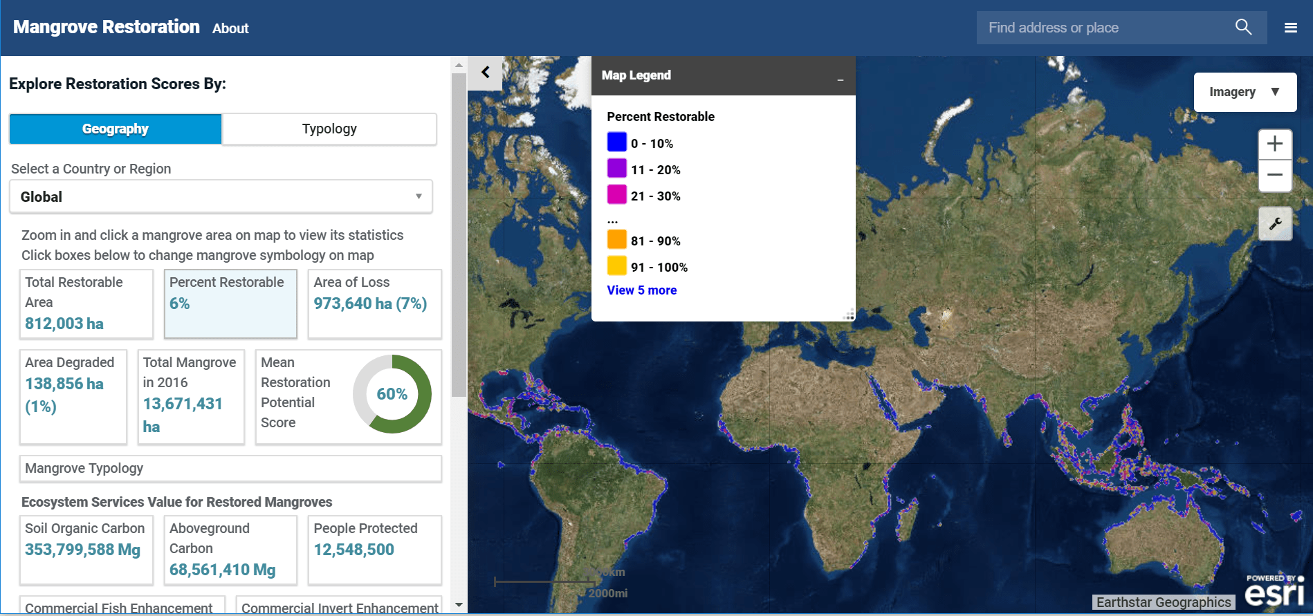
 The map provides additional guidance as to where restoration is likely to be successful. In this work, mangrove experts from the University of Cambridge, The Nature Conservancy, and IUCN merged data from Global Mangrove Watch to develop a map of the maximum extent of mangroves over time (1996-2016), identified areas of losses, gains, and degradation, and developed a model to predict the factors most likely to facilitate restoration.
This mapping tool offers decision-makers the ability to know where restoration should be attempted by identifying locations where mangroves once thrived, and where conditions remain suitable for restoration. The tool also calculates what ecosystem services might be gained from their restoration.
This tool provides information at broad scales. It helps to guide decision-makers towards options for restoration. Once decided, practical restoration planning always requires local knowledge of ecological, social and economic circumstances in order to ensure successful, long-term outcomes. Learn more about how to use the tool with this interactive story map.
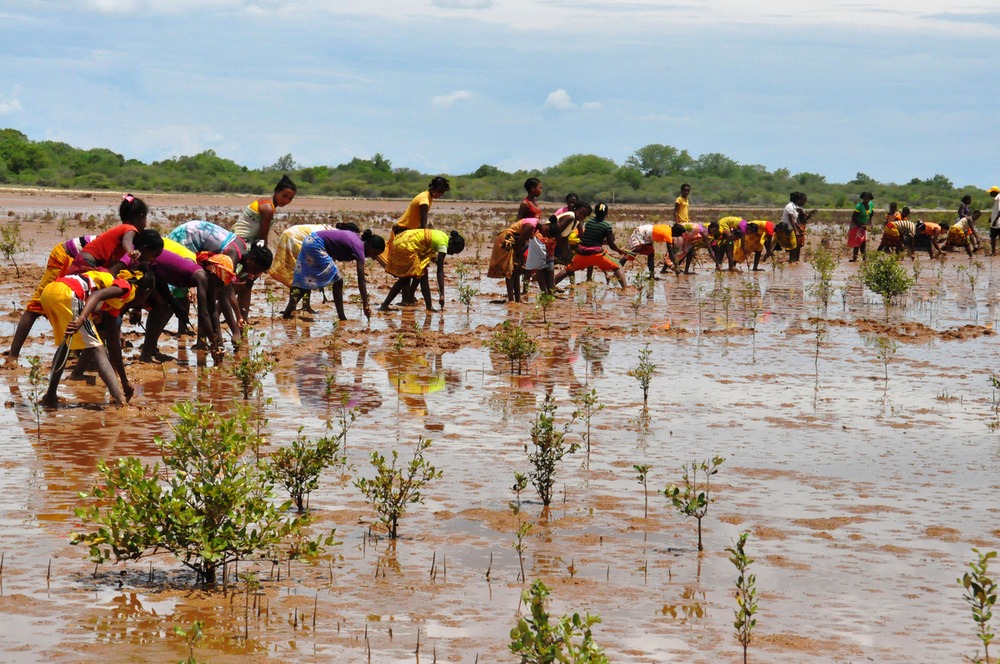
Community mangrove restoration in Madagascar (Source: WWF-Madagascar)
